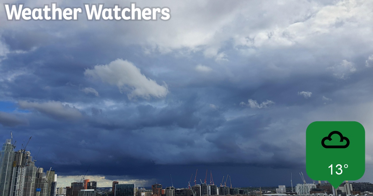
WHACKING showers and blasts. Still ominous from North.
Stormy Weather II
Collapse
X
-
 Guest
Guest -
.
.Originally posted by Serial_Apologist View PostAs to thereafter, there are vague signs after the 20th of the Azores High at last getting its act together and the Greenland High retreating Polewards - in which case, while the weather regime remains "zonal", i.e. coming at us from the west, there is a greater chance of a return at last to normality, with ridging from the south-west bringing up pleasantly warm Maritime tropical south-westerlies and rain-bearing fronts pushed further north, or weakening into relatively innocuous features when they cross the UK. While this is further ahead than models can accurately predict, and with the cautionary proviso of climate change tending to upset the apple carts these days, changes in weather type are pretty commonplace at the start of June.
.Originally posted by gurnemanz View PostLet's hope SA's ... para above bears fruit.
... indeed so - we're heading up to Northumberland for a week from 20 May - had planned on Crete, but thought better of it. Let's see if the North Sea off Blyth can compare with the Aegean off Chania...
.
Comment
-
-
9C and no sun. Has November arrived early?
I was reading the preview of today's Gardener's World. Monty plants out his tomatoes. Bit premature surely.
Comment
-
-
Talking to them might encourage them.Originally posted by gurnemanz View Post9C and no sun. Has November arrived early?
I was reading the preview of today's Gardener's World. Monty plants out his tomatoes. Bit premature surely.
Comment
-
-
I would have said so, but I suppose he's got plenty more if the first lot don't survive. Those of us with less spacious premises have to be more careful. My young plants have had two days out, the first was lovely and warm and they enjoyed it, the second there was a chilly wind and some of the leaves have gone purple in response. Today is blooming chilly - warm jacket, scarf and gloves for walk to town for shopping - so they are under the shelter of the pop-up plastic growhouse. They'll be coming in at night for a good while yet.Originally posted by gurnemanz View Post9C and no sun. Has November arrived early?
I was reading the preview of today's Gardener's World. Monty plants out his tomatoes. Bit premature surely.
Comment
-
-
Yes indeed, remarkably cold today, even for this particular spring: people out and about dressed for winter - bobble hats, overcoats, "Mr Michelin"-type jackets, gloves. Somehow nature is almost keeping up with time of year: the path between the sports grounds adjacent to Dulwich Hamlet stadium is at its best around about now: scented hawthorn and cow parsley blossoming in a bun dance! I can only conclude the 13 C registering on my thermometer must be being affected by heat emanating from somewhere with an open window!
Edit: Really dull now - wouldn't surprise me if some light rain or drizzle emerged from this thick double cloud blanket over us.
When out shopping an hour ago, I decided to postpone the decision I usually make around now to switch from cooked to salads for main meals, and stick to that until around late September/early October when temperatures start to tumble. Daytime maxima have to be regularly exceeding 17 C for me to change, and sadly it doesn't look as if they will even reach 16 C for the whole of next week. Last edited by Serial_Apologist; 14-05-21, 16:26.
Comment
-
-
 Guest
Guest -
It's the same approx 60 miles to your north!Originally posted by Joseph K View PostRaining non-stop and DARK. I'm about to put a light on - I can't remember ever feeling the need to do this at this time of day and this time of year!"The sound is the handwriting of the conductor" - Bernard Haitink
Comment
-
-
Similar here, although light breeze rather than wind, which did much to make the temperatures less challenging. Showers mostly light and intermittent until early afternoon, but then clearing away after a short period of heavier offerings.Originally posted by DracoM View PostShowers - well, sort of.
Grey, SE wind. Lazy weather yawning its way across us.
Going back to #7295/6/7 it was planting tomatoes out in the greenhouse borders I think (only caught the last few seconds of that bit of the programme), which makes more sense than what we assumed.
Comment
-
-
Massive crash of thunder here a few minutes ago, which Lightningmaps indicates being as far as 4 miles to the south, in the middle of Croydon, so probably some of the multiple lightning conductors sited on the tower blocks located there got direct hits. I had walked around the block here ten minutes before to note the approaching black cloud, and warned upstairs, who are using my vac to clean their car, that they might be in for a soaking, but most of it has skirted round to the south.
The 14 C reached around lunchtime will probably be a high as it gets today, the storm now having substantially cooled the air. This pattern seems to have established itself for the next few days, with quite deep, cold low pressure centres hanging around - the possibility of gales next Thursday can't be ruled out either.
Comment
-
-
Really nice pic of that storm, taken from Pimlico, and showing clearly the threatening darkness of that cumulonimbus base. Quite a complex cloud mass for a simple afternoon pulse-type storm, which only produced that one strike, showing the building cloud mass disappearing into what is either stratocumulus or low altocumulus outflow cloud, and a fragment of scud nearer to the photographer (at about 10 o'clock):
Comment
-

Comment